How Geodata Can Support Humanitarian Aid in Catastrophes
7. Juli 2016
Klaus Tschira Foundation funds project to establish the Heidelberg Institute of Geoinformation Technology
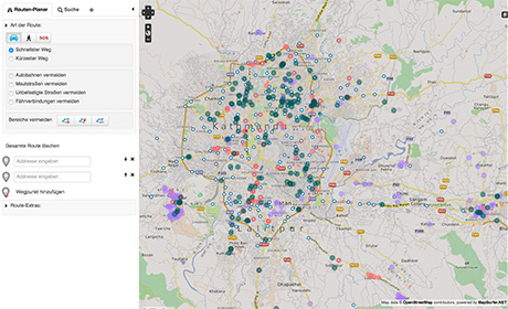
Map: openstreetmap.org
Funding from the Klaus Tschira Foundation is earmarked to establish the Heidelberg Institute of Geoinformation Technology (HeiGIT) at Heidelberg University's Institute of Geography. HeiGIT's task will be to transfer knowledge and geodata-gathering technologies from basic research to practical applications, such as how to harness large and heterogeneous data sources to support humanitarian efforts when catastrophe strikes. The Foundation has made available more than three million euros to establish HeiGIT. The work will be led by geoinformatics expert Prof. Dr Alexander Zipf.
Prof. Zipf's team has already implemented emergency routing and navigation services, which feed information from various sources – from OpenStreetMap via Twitter to Flickr or Instagram – for anyone's use. After the devastating earthquakes in Haiti and Nepal, the Heidelberg geoinformatics scientists rendered immediate assistance to rescue teams on site by providing aides and operational centres with answers to important questions: What streets are still navigable? Where is the destruction especially great? What areas can be accessed or evacuated in a certain period of time? How reliable is the information provided by citizens? In addition to advancing the "Geodata for Humanitarian Aid" project, the Heidelberg researchers also want to address two other areas of importance under the auspices of HeiGIT, including location-based services, such as special route planners like OpenRouteService, and big spatial data analysis for evaluating large amounts of data.
"New methods for collecting and processing geodata from very large and heterogeneous data sources are essential not only for catastrophe management, health planning and environmental monitoring," explains Prof. Zipf. "They are also extremely important in urban and regional planning, such as in mobility research, and in traffic management." According to Prof. Zipf, big spatial data analysis also includes the automatic assessment of data from social media, which the Heidelberg Institute of Geoinformation Technology will also research. Information from social media can be used to supplement data from government offices or satellite or aerial photographs.
Geoinformatics research in Heidelberg had its origins in the European Media Laboratory (EML) founded by Klaus Tschira in 1997. Alexander Zipf was the first doctoral candidate and postdoc of Heidelberg University to conduct research there. He was a researcher and professor in Mainz and Bonn before returning to Heidelberg University in 2010 as Director of the Geoinformatics Department of the Institute of Geography.
The German foundation Klaus Tschira Stiftung was created in 1995 by the physicist Klaus Tschira (1940 - 2015). The foundation promotes the advancement of natural sciences, mathematics and computer science and wants to raise appreciation in these fields. The Foundation’s commitments begin in the kindergartens and continue at primary and secondary schools, universities and research facilities. The Foundation champions new methods of scientific knowledge transfer and supports both development and intelligible presentation of research findings. The Klaus Tschira Stiftung pursues its objectives by conducting projects of its own, but also awards subsidies upon application and positive assessment.